
Welcome to the Interactive Guide
Hurstpierpoint, Hurst-per-point, there are so many This-hursts and Hursts-that, let us, at the outset be clear; we call it Hurst!
As biographer Charles Michael clarified in his biography of Bishop Hannington, who you will encounter later on in this Trail; “… Hurst, for so the inhabitants shorten the some what cumbersome name of their village.” Hurst it is then!

Before you start, although this is a constant work in progress, you need to be aware that there is too much information to see that may mean a very slow yomp! Where there are bold green directional instructions, there are links to more information about where you are, and further links within the text (coloured green) that you may like to return too later as you may prefer to be looking up, not down! ALL green coloured text contain links. Most pictures will expand when clicked. If you are not standing at the START of the Trail click this link to WHAT3WORDS to find it!
If you want to just walk the trail, then you can just go from one green marker to the next, and revisit the text at leisure. it will be worth it!
Bite-Size Heritage Trail – Families with Children are encouraged not to do the whole trail in one go! Decide on sections to do, and come back another day!
Click on the Map (below) to open it in a new window, and flip between these two pages as you go!
If at anytime you’re not sure where you are,
just click the next green numbered marker
to navigate your way there!


William Ellis Smith 1837
Early Times
A Roman road ran to the south of the village, with a villa nearby, but the present village dates from Saxon times. Hurst (Hyrst) was most likely to be the Saxon word for ‘a clearing in the forest’. Vast tracts of the Low Weald were forest (Andredsweald), woodland and shaws. Hurst runs along a greensand ridge, providing fertile soil rather than the clay lands to north and south, with the chalk Downs beyond.
In the Domesday Book, 1086, it was held by the Pierpoint family who came here from Normandy with William the Conqueror.
By Tudor times a substantial area formed part of Danny Park. Danny, a mansion to the south, now a retirement home, was built by 1586, replacing a medieval 13th Century hunting lodge.

This earliest known map shows the 2 deer parks Danny Park (Great Park) and Hurst Park, later to be known as Little Park.

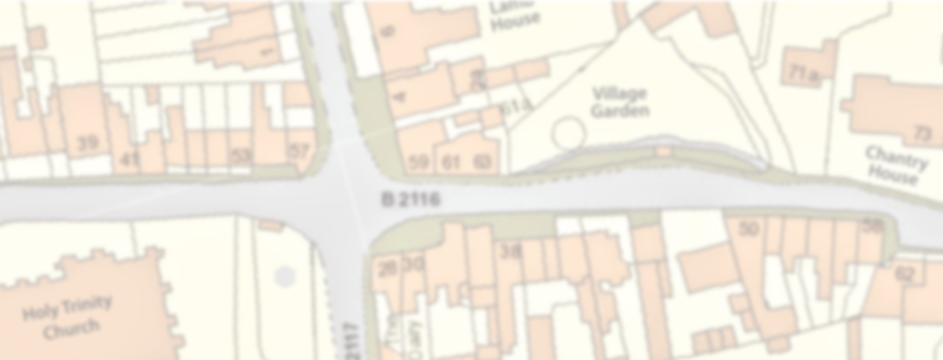
From the car park notice board, turn towards the Community Charity shop. On the flint wall in front of it, you see were there was a gateway that led into the kitchen garden from Chantry House, the large white house beyond the wall. The shop was the stables… more about that later.
Go left up the steps into the Village Garden.
The memorial Pierpoint post stands here. Erected in 1968, there is a brass plate telling you who did this and why. See the sculpture ‘Children of the Fair’ by local artist and sculptor, Sylvia Thornhill. It was installed to celebrate the 7 centuries of the village fair. See the inscriptions around the base.

Go to the roundabout & turn right into Cuckfield Road.


This area at the top of Cuckfield Road was a livestock market known as Lamb Platt. Lamb House was built by Richard Weekes as a coaching inn in about 1835, when the new turnpike road came straight down from the north. It was hoped that the London to Brighton stage coaches would follow that road (see the arch through to stables and barns) but they continued to use Stone-Pound Gate near Hassocks. The disappointed Weekes changed part of it to a beer house, The Lamb Inn. You had to take great care going in the door, as the dart board was on the inside of it!

Lamb House was called Belle Vue. For much of the early 20th century it was a private girls school and then tea rooms and hotel (above), now fully restored to a private house, retaining the name Belle Vue until at least the 1950’s. Also, the Inn is now a house.
Go back to the roundabout and turn right on High Street/Albourne Road.


Cornelius G King
Across the road, the War Memorial was unveiled on St. George’s Day, Sunday 23rd April, 1922 by Colonel William Campion. It recorded the 77 villagers that fell in the 1st World War. Although Harry Clarke’s name is missing the ‘e’, very recently, the 78th name, Cornelius G King, that was missed has now been added! William Campion died the following year, and it was his wife Gertrude who soldiered on to unveil the Derbyshire Alabaster memorial to the 78, in the Campion transept inside the Church. There are a few that are also recorded on other memorials in the area, for example at Albourne.
The area around this east wing of the church had been a vibrant market place. With the advent of the turnpike New Road, now Cuckfield Road, the market was known as The Crossways. It is likely to have been a market long before.
How Crossways has changed. It is now where we get our fish & chips!

The medieval/Norman Church of St. Lawrence (below) was replaced by the present Holy Trinity Church, built 1843-45 to accommodate a rapidly burgeoning village; designed by Charles Barry who was the architect for the Houses of Parliament and St.Peter’s Church in Brighton, among others. If the door is open, please enter, and you will find the extensive ‘Church Notes’ by John Norris, or click here!
The old Church of St. Lawrence (below) underwent many alterations and additions over the centuries. The massive Norman tower was one of the few parts of the original Domesday building that survived until it was entirely demolished in 1842.

The tower, with its clock by eminent and fashionable Victorian “Clockmaker to the Queen”, Benjamin Lewis Vulliamy and its ring of eight bells, hold a special place in the soul of the village. There is a talented band of Bell Ringers and the chimes of the clock every quarter hour are a delight. You are bound to hear The Bells chime at some point in your trail!


Not quite Soho, but you are now in the ‘West End’... of the High Street, North side: Where is No.43? The gate access led to the communal washrooms and lavatories. These have now been replaced by No.43, which cannot be seen behind No.45, through the gate.
As you continue eastwards there are 5 large houses, Nos. 19-27, collectively known as St George’s Terrace, were built around 1839. Remains of what were believed to be the original 12th century Pierpoint Manor house were found here during their construction. The manor was used centuries before the building of Danny Mansion to the south east of the village. See the insurance fire marks up high on the walls. Can you see any on the south side? Fire insurance was clearly good business here. You will see why soon!
You will notice that No.19 and 25 have bay windows. These were stores. To the right of the picture below was ‘Stevens’.
At the roundabout, we have already met Clement Peskett, circa 1850 at No.17 is the larger projection, the chandler’s shop of William Peskett adjoining the corn merchant; Thomas Peskett.

In Victorian times there were several pubs on this road, Nos. 27 and 9 have extensions in front of the general building line (below), indicating clearly that they were beer-houses, The Red Lion, now a private house called The Old Lion and The Oak.

Until very recently, this was the Heath Veterinary Clinic. In 2022, the new owners discovered the original Ale House frontage, and kept it!


The oldest of the houses along this road dates from 1550. The section of the 1841 Plan (below) surveyed by James Fisher, shows how little this part of the High Street has changed, despite the new church that began construction two years later, apart from the clearly defined area along the turnpike where Lamb Platt remained on the west side of Cuckfield road and the ‘Crossways’ Market Place was, and where the War Memorial is now.

More about where you are here, or carry on to the corner….

Are you here yet?!


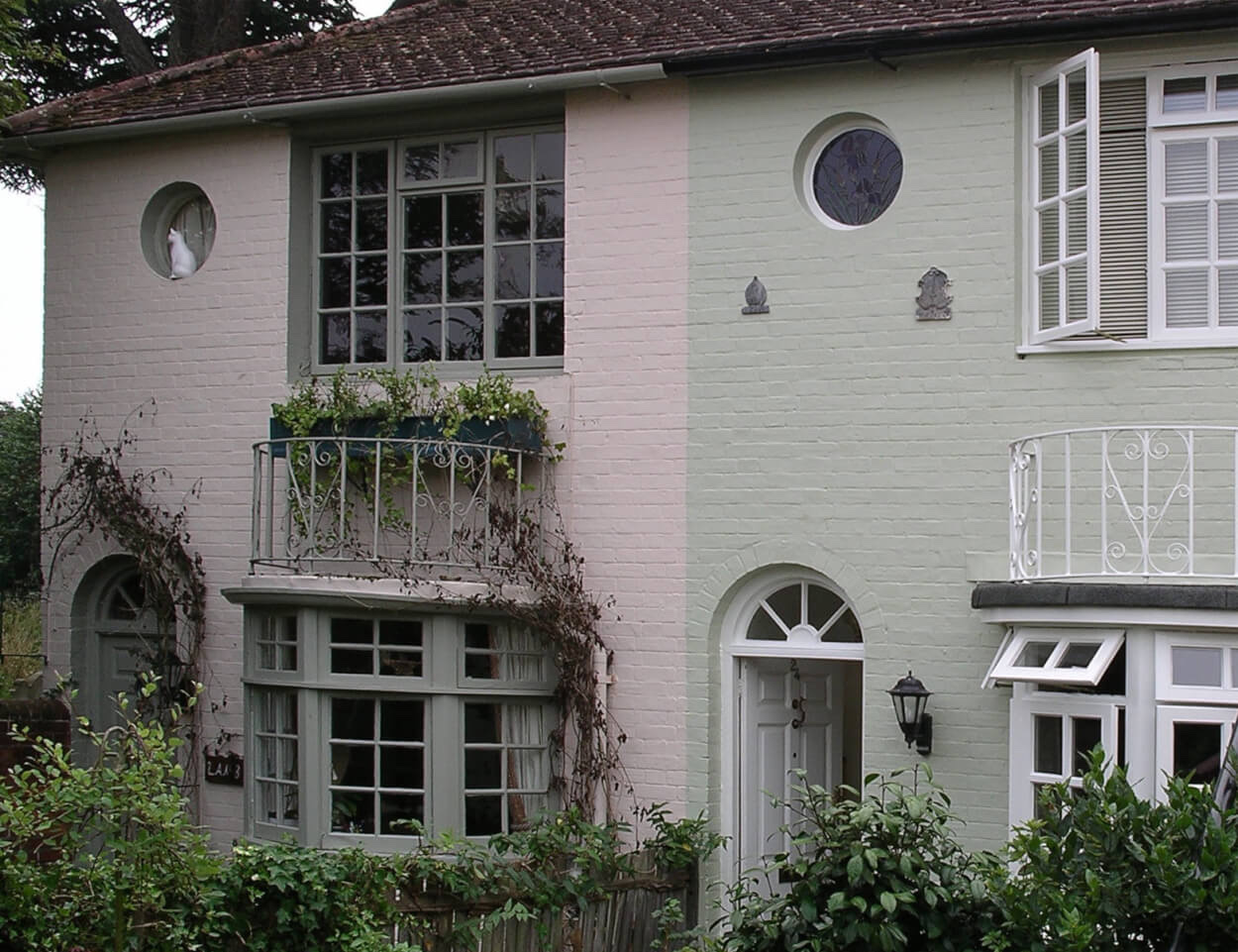
Across the road on the bend is Treeps. Two cottages, now one house, were built about 1700. John Treep, a metalworker, lived in the west ⅓ and carried out repairs to locks or fitted ferrules to walking-sticks, for the farmers. His small forge still exists in the sub-basement (take a closer look at the gate!). When he died in 1729 he left 10 shillings for the bell ringers to have drinks after his funeral.

Pharmacist and bryologist, William Mitten who lived here for most of 19th century, had a great interest in botany, studying the mosses of New Zealand and South America. He was considered the leading authority on them.
The plaque remembers the stay in the house 1867/8 of Alfred Russel Wallace OM, where he wrote his book in peace and quiet (The Malay Archipelago). His concurrence with Charles Darwin was instrumental in Darwin’s publication of The Origin of Species, the Theory of Evolution. He married Annie Mitten, one of William Mitten’s four daughters, in 1866.

Treep’s Lane, as it was previously named and recorded, now Policeman’s Lane, was one of the oldest tracks into the village, until the Albourne Road became a turnpike in 1771.
Just down the lane is “Cowdrays”, built in 1609 and bought by the Cowdray family in 1631. It was modernised in 1717 with an internal staircase installed.
No need for pictures here! The views to ‘Campion’s Eyebrows’ on Wolstonbury Hill and across Washbrooks Farm and west along the Adur Valley speak for themselves! You notice how close the village is to open country, with footpaths running to the South Downs, south east and southwest… for another day perhaps!
If the lane is not too muddy continue along it and turn left when you meet the Brighton Road, then turn right back into the High Street. Otherwise, retrace your steps to the roundabout and carry on up the High Street.
Can you see the unicorn on a building just past the wine bar to your right as you pass the Village Garden again on your left?
Chantry House, the large white house on your left, just beyond the garden and wall, was used by the Rev. Carey Hampton Borrer as his rectory in 1841, having been bought by his father Nathaniel in 1837. These were turbulent times in the church and a high wall used to surround the property and garden, that seemed to separate the parish priest from his flock.

You can see where this wall started and ended adjacent to the High Street. The north-west and east walls are still there. Borrer also reversed the aspect of the house in order to be able to look out over Little Park, to the northeast, rather than the High Street.
Carry on up the High Street.

endured and survived The Great Fire ….


On Friday 27th January 1882, fire broke out in the white terrace on the right. It was not helped by one owner, Walter Fitch (above), keeping gunpowder. The Great Fire burned for 3 days. The whole terrace had to be re-built with the archway being one of the few elements remaining intact. There was then a butcher’s slaughter house through the archway. The first tenant butcher was Allen Botting, later the butcher was AJ Baker. You can read more about this extraordinary event here.

Despite help from Masters & Tulley (owners of the department store, who you will meet later), Walter Fitch never returned to his uninsured shop. It was used by Dr Henry Holman and later was occupied by ‘Saddler’ Smith. Later still, it was the electrical contractors Boxell and Bryant.


Chichester House, formerly called Brick House, is now divided into the three properties that are The Odd Corner, Chichester House and Bieldside (formerly Beals).
It was used as a training school for girls, especially from the workhouse, to become domestic servants. Girls who became pregnant while here, had to wear a special grey gown with yellow stockings.
By 1841 it was owned by the lawyer Lawrence Smith, who later changed the name to North House (possibly to disassociate himself from Brickhouse). It was dramatically saved from the Great Fire In 1882.
However, he sold it two years later to Mrs Gertrude Campion, the wife of the Lord of the Manor at Danny, who established a less draconian ‘Diocesan Training Home for Workhouse Girls’, hence the 3rd name change to Chichester House. It also provided refuge for unemployed or recuperating girls. A donkey cart with Danny’s laundry was a regular sight through the village. After training, girls were found posts with families, not only in England, but were sometimes given assisted passages overseas, for example to Canada. The School continued until the 1920s, then the building was split into the three houses you see today.

A house called Matts was here in 1553. Matts was the Rectory for a while in the 17th century.

In the late 18th century it was bought by Richard Weekes to set up practice as an apothecary-surgeon. This began a medical, archeological, construction and philanthropic dynasty, becoming a long and historic connection and contribution to the heritage of the village. Richard Weekes’s son, George rebuilt Matts in 1855, renaming it Carey Hall.


The Weekes Diaries (left) begin to tell the tale of this extraordinary family. In due course more extensive links will be provided here, but you will come across this family again in this trail.
In 1954, Matts was renamed Norfolk House.
Next to it is Down House. During the 18th century this was the inn called The Swan.
Go through the gateway into West Furlong Lane.

Look through the wooden archway of Oldways, on your right, then stop and look at the group of houses as the lane curves around to the left.
Oldways, Yeomans, Carys and Oldways Cottage were all adapted in the 1930s by architect John Denman, who lived at Oldways. He was a devotee of the ‘Arts and Crafts’ movement of the end of the nineteenth century, and these properties display iconic touches of this particular style.
In the corner facing the High Street are the converted Parish Rooms. The foundation stone of 1890 indicates the active collaboration between the Manor and the Church, Mary Gertrude Campion and Margaret Borrer, being the children of the families of the Squire and the Rector respectively.

Go through the next gateway further into West Furlong Lane.

On the left, see the wall bordering the lane and the flint tower; both crenellated. There is a theory that these two structures were so embellished to give the impression of fortification as seen from the South Downs and from the west.

Clearly no effective defence would have been possible, but is worth remembering that they were built in the first decade of the 19th century, when there were no houses on the south side of the lane, giving an open view of Hurst from the Downs and the Adur valley to the west, when the fear of invasion by Napoleonic troops landing in the shallow Brighton Bay area was very real. (see pages72/73 of the book ‘Danny House’).
Documents exist of the plans for evacuation of women, children and the elderly to places of assumed safety farther north, detailing the farm wagons and horses to be used in such an emergency. In 1804, Campion of Danny had deployed a troop (of young farm workers) to light a beacon on ‘the hill’ (Wolstonbury).
Fortifications were being built all along the southern coast, with Brighton being a vulnerable and defended stronghold. So although unknown, the case for the reasons for the crenellations and tower can be argued probably with more weight than that of just being a coincidental folly.
Carry on along the walled alleyway

Cattle were still grazed on this common field up to 1900. It was called the Town Field until the Manor transferred ownership to the Parish Council in the early 20th century. It is possible that it may have been farmed communally in medieval times.
The field is now the home of Hurst Bowls and Lawn Tennis Clubs and the largest children’s playground in the Parish.

Thousands attend St. Lawrence Fair here every year. The painting of the Summer Fair (above), is the 2nd of four paintings by Lyndsey Smith, commissioned for The Society by Toby Lott’ celebrating the four seasons of Hurst. …Future Heritage.


Walking towards the High Street, on the left, modern cottages replaced Townfield Cottages (below). These in turn were converted from the parish workhouse. In the early decades of the 19th century it was occupied by more than 100 inhabitants at any one time. It was closed in 1845. Residents were sent to the new Cuckfield Union Workhouse.

Opposite is the building originally holding the village Forge.

Walk to the High Street and turn right.

The building central to the parking bay (104-106 High St.) is Hamilton Lodge. In 1800s this was a boarding school; one pupil was the notorious artist and illustrator Aubrey Beardsley.

Above is one of Aubrey Beardsley’s less risqué works! Like his friend Oscar Wilde, much maligned, he was a contemporary feminist before the concept was thought of. Perhaps that’s his sister Mabel. A year older, and taller. We know he was inspired at Hamilton Lodge. .. and this certainly could be Holy Trinity Church and Wolstonbury Hill (?)
Carry on down the High Street.

Opposite is the old fire station. After the Great Fire of 1882, Dr Constantine Holman gave a fire engine in memory of his father Henry, a fellow Doctor who lived in Hassocks Road. The first building to house this machine was built here, adjacent to Arthur Anscombe’s house, No.127. This private house retains this spectacular garage! Hurst’s fire station is now in Cuckfield Road, by the junction with Chalkers Lane.


Opposite again, the large white building behind the recently restored railings is Townfield House, (previously Town Field House) built for William Mitten, the retiring butler from Danny House. His son, we have already met at Treeps, William Mitten [Jnr], the village chemist and renowned bryologist, followed in this role by his daughter Flora, one of the first women to qualify as a pharmacist.
Townfield House and a later occupant Frank Mason, a co-founder of Hurstpierpoint Society in 1962.
The delightful painting above depicts his daughters Elizabeth and Diana.

To the left (above) is the former entrance to Harper & Eede – Agricultural machinery merchant who moved to Albourne after being taken over by Ernest Doe, to make way for the aptly named Trumpkins, a small recent housing development on what was Trumpkins Farm. Next to The Poacher is Grapevine Cottage.


Further on the left you can see the Players Theatre. This was first built as a chapel in 1817, then became the National School in 1819, which subsequently moved to its current location in Cuckfield Road 50 years later. The building then became Gravely’s (a grocer), before its present use as a theatre and Hurst Village Cinema. To its left, now drastically altered, was a fish shop with a tenement of three cottages called School Row, and the alley between them was called Fish Alley.

For the Short Trail, turn back along the High Street,
to the twitten between Hampers and Truffles
‘Ian Nelson Walk’
to pick up number 27.

Further on the left is the early 19th century terrace resembling almshouses. In fact until very recently corrected, they were listed as such. They weren’t, and aren’t! There is a faded wall advertisement on the western façade for the two former shops to the left, and the gate access was to the communal washrooms.
The central original house was built earlier. Although matching, evidence shows the two sets of 4 houses either side had an entirely different method of construction. Recent renovations to some of the internal dividing walls among the group of four houses on the right side seem to show that they were initially low garden walls and the floors were very basic.


The village expanded here in the early 19th century with expensive villas, though first on the left is St George’s Cottage, with the old St George’s Laundry beyond it.

See the cow!… One of many from the 2007 Hurst Festival, another wonderful annual Hurst event. …Her name by the way, is Esmeralda!
Across the road is Hampton Lodge, built in 1830 as a wedding gift for Dr Richard Weekes. The listed gate pillars, and matching set and properties, Thurles and Vine House on the other side of the road, bear the ammonite hallmark of renowned Brighton architect and builder Amon Wilds. The design of the house has striking similarities with Howard Lodge, that you may have seen earlier at the other end of the village.

St George’s House was built before 1834, and bought by the Hannington family. They had a large department store (‘Brighton’s Harrods’) which only closed in 2001. In 1949, St George’s was bought by West Sussex County Council and became an old people’s home for the next 30 years. Later in the trail you will pass through some of the original large gardens. The plaque by the door is a memorial to James Hannington who, as a missionary, became Bishop of Eastern Equatorial Africa but was speared to death there in 1885. St George’s is now private apartments.


Gothic House, a grade II listed building with the cinquefoil on the upper story, castellations and gothic facia, together with its Georgian features suggest this was possibly another designed by the Brighton architect Amon Henry Wilds, although this is not proven. It was built as two dwellings between 1826-1837 on a plot of land previously part of The Bantry Field, part of Little Park Farm (which you will come to later). By 1871, half of it became a girls’ school. It is likely the whole building was incorporated into the school about two years later, and the 1881 census records Fanny Rowland, its founder and school mistress, her parents, another school mistress, four assistants, two servants and 26 boarders [students] living in “Gothic House, Ladies School”.
Together with later associated structures behind, it is now 4 dwellings.
Turn left into St George’s Lane.

At the corner is St George’s church. Recently converted to a private residence it was built in 1852 by Charles Hannington who disliked the tractarian sympathies of C H Borrer, the rector of Holy Trinity. It is not aligned to the East in the traditional Anglican way.

Just past it enter the gate on the left into St George’s Green.
The Green will be the future Hurst Cemetery when the current cemetery in South Avenue (south of the Recreation Ground) has reached capacity.
Follow the path into the Millennium garden.


The St. George’s Millennium Gardens Trust was set up in 1999. A Hurst district councillor, Susanna Kemp, raised £6,500 with villagers for a long lease of these, the original St. George’s House gardens, from the County Council. Opened in 2001 by descendants of Bishop Hannington, the garden has now passed to the Parish Council, forming part of Hurst Meadows.
See the wood sculptures carved by Alasdair Craig from the Monterey Pine that stood here.


On the right lie Hurst Meadows. This area is now owned by the Parish Council for the benefit of villagers. Enter through one of the gates and see how close the village is to open land to the north, with a wonderful view of the chapel at Hurstpierpoint College, with Cuckfield Church and the North Downs beyond on a clear day!
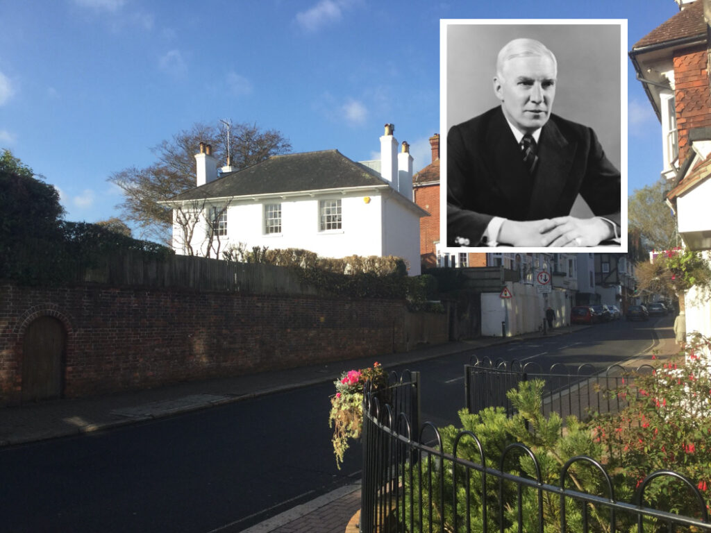
Leave the Millennium Garden either by following the footpath and turning right into Brown Twins Road, or through Hurst Meadows aiming for the bottom left hand corner, and follow the footpath! Either way, you will reach Trinity Road. Just past the Health Centre, the gates to Little Park Farm are on the right.


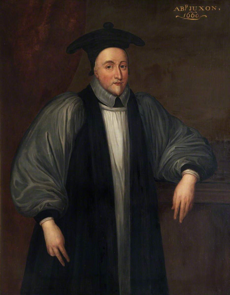
The most prominent figure to (briefly) live at Little Park, and indeed the village, was William Juxon (1582-1663). An extraordinary figure who managed to survive the political and sectarian clamour and brutality of the Civil War. He was:
President of St John’s College, Oxford (1621–1633);
Vice-Chancellor of the University of Oxford (1626–1628);
Dean of Worcester (1628–1632);
Clerk of the Closet (1632–1633);
Bishop of Hereford (1633);
Bishop of London (1633–1660);
Lord High Treasurer (1636–1641);
First Lord of the Admiralty (1636–1638);
Bishop of London from 1633 to 1649, until Charles l selected Juxon to be with him on the scaffold and to offer him the last rites before his execution. Juxon survived to the reign of Charles ll to become;
Archbishop of Canterbury from 1660 until his death.
This was originally one of the largest farms of the village with a deer park and carp lakes (still in place). Much information about the village is in the diaries of Thomas Marchant, who lived there from 1714.


On the left, by the memorial bench to Rosalind Mead, you enter the Twitten (the Sussex name for a passageway); Ian Nelson Walk. Beyond the Health Centre On the left…
– The Short Trail Rejoins Here! –
(Ribbetts – 40m down the twitten, on the right… )
are Ribbetts Cottages; eight cottages (five parallel to the pathway; three at right angles, now converted into one dwelling) were built for workers at Little Park and Trumpkins farms.
In 1841 the cottages were un-numbered, but ten years later they were the first to be so identified, at least fifty years before the properties in the High Street itself.
Go towards the High Street
Further on, see the unusual brick bonding on the walls. As you reach the High Street look at the old graffiti carved in the sandstone wall. Please don’t add to it!


It never failed to make him chuckle!
Opposite you is the terrace called Cards Place which replaced the insanitary cottages known as Hardings (below, right), completed in 1900. It was named after Philip Card who lived where the greengrocer’s shop is now. Can you read the Latin inscription? It means: “I however and my household serve the Lord”. To the right of the inscription you will notice the Pagan symbol of ‘The Green Man’.

To your left, the building projecting towards the High Street was here in 1450, and so is almost certainly the oldest and earliest documented building. This was Upper Trumpkins, part of a farm holding which stretched eastwards to the end of the High Street as far as where The Poacher (you passed earlier) is now. A later incarnation was as Curds’ Store. Upper Trumpkins and Hardings, as seen above, marked the eastern extent of the High Street until Townfield House was built on Town Field (Now South Avenue Recreation Ground).

Cross over the street by Pitt Lane, which originally led to saw-pits.
Opposite, now Cruise Line, is the unmistakable profile of Barclays Bank. Last time I knew, the bank’s vault was still in the cellar! (I’m sure I’ll get corrected though!)


Look at the long building to the left which includes the Co-op and Pierpoint Pet Supplies among others. This whole building was originally a large department store, Masters & Tulley. Despite having expanded across the road, next to the New Inn, to accommodate their furniture department, the store closed in the 1960s.


The New Inn is one of the oldest buildings, originally a grand timber framed wealden hall house, built in about 1500 with later stone and Georgian brick frontage. On the west wall you may see an old window that was covered in rabbit skin when glass was expensive. The inn gained its licence in about 1810 when the pub opposite, the Royal Oak, was closed because of rowdy behaviour.


Alongside you find the Mansion House, built about 1575, using older beams inside, which have been dated to the 15th century. Its Georgian exterior was re-built about 200 years ago. Hurstpierpoint College (which you may have seen from Hurst Meadows), is part of the Woodard Schools, began life here as St.John’s College, as the plaque by the door states. Archaeologist, Maggie Henderson was commissioned to survey this building’s heritage for recent renovation works, and a great deal of her research on Mansion House is here.

Across the road is Wickham House. It is not all it seems. We have an early 18th century wooden frame house, with a large inglenook fireplace within. The “bricks” are actually mathematical tiles, with wooden quoins.
End of trail! – Browse the shops, or return to the car park or stop for refreshments at one of the many purveyors of sustenance in Hurst.
We hope you have enjoyed our Interactive Heritage Trail.
A voluntary donation to cover the work that has been put into it here would be most welcome.
We suggest a donation of £5.
Please join the Society here, and help preserve our community’s wonderful heritage.
Come back soon!
More is on the way;
Updates to this walk, and there may be another 10 walks added!
Devised by David Clarke
Designed, collated and edited by
Christopher Maidment
including many words by David Clarke and the late Ian Nelson
with very warm thanks to John Norris, Rae Heaviside and Bill Kent
August 2020
Every effort has been made to provide as accurate a guide as possible. Please let us know if we have erred! Neither The Hurstpierpoint Society nor Hurstpierpoint & Sayers Common Parish Council are responsible for any inaccuracy. Please refer to Data and Privacy policies available on both websites.
For Ian
Bibliography
- SLIGHT SKETCH OF A Picture of Hurst BY A NATIVE OF THIS VILLAGE.
Grace Weekes – 1826 - A History of Hurstperpoint – By a Native, A Minor
William Smith Ellis – 1837 - SUSSEX Archaeological Collections, Relating to the HISTORY AND ANTIQUITIES OF THE COUNTY – VOL.Xl
The Sussex Archeological Society – 1858 - THE LINNEAN
Newsletter and Proceedings of the Linnean Society of London 5-3-1989 - HURSTPIERPOINT – kind and Charitable
Hurst History Study Group – Edited by Ian Nelson – 2001 - WHO’S BEEN LIVING IN MY HOUSE? The occupiers of Hurst High Street properties in Victorian Times
Hurst History Study Group – Edited by Ian Nelson – 2010 - DANNY HOUSE – A Sussex Mansion through Seven Centuries
Colin and Judith Brent – 2013 - HURSTPIERPOINT SCHOOL – ‘To be larned, not washed’ – Three centuries of village education
Hurst History Study Group – Edited by Ian Nelson – 2006 - A fine day in Hurstpierpoint –
the diary of Thomas Marchant 1714 – 1728
Hurst History Study Group – Edited by Anthony Bower – 2005 - HURSTPIERPOINT COLLEGE 1849 – 1995 The School by the Downs
Peter King – 1997 - The Weekes Diaries
19th century Hurstpierpoint through the eyes of the medical practitioners Richard and George Weekes 1800 – 1872
Hurst History Study Group – Editor: Ian Nelson Genealogical Annotation: Anthony Bower – 2005 - Hanningtons, a Brief History 1808-2001 – Bond, Sidonie
- Indices of Species of Mosses and Lichens Described by William Mitten –
MEMOIRS OF THE NEW YORK BOTANICAL GARDEN VOLUME 68
Barbara M. Thiers
… more information
The Roundabout (formerly Crossways)
There are several things worthy of note here. The buildings on the east and west corners of Cuckfield Road were erected as ‘lodges’ soon after the completion in 1835 of the Turnpike Road from Hurstpierpoint to Ansty Cross, known for many years as New Road, now Cuckfield Road.
In the North east corner there is a long list of retail trades: beauty salon, ironmonger, watch-maker, among others, with pastry-cook and confectioner Thomas Heathorn (below, circa 1900). Left is The Lamb Inn.

Likewise, on the west side, various guises, in recent years, The Cook Shop, (Vic) ‘Hilton’s; electrical, radio and television retailer and engineer. Contemporary with Heathorn, the premises were those of Clement Peskett, (below) a tailor, bolts of cloth being displayed in the window.

On the south-west corner of the crossroads some stone blocks are the remnants of a combined horse-trough and drinking fountain (below), donated by the Holman medical family (more about them later!). The picture shows George Stoner, Landlord of The Lamb Inn filling a water-cart before damping down the dust on the road in the days before there was an asphalt surface.

Back to where you were… in the 21st Century!
… more at the west end of the High Street…
Dunstall’s (south-side) had been occupied in 1662 by Edward Hollingham, the rent being one shilling; and in 1703 by Thomas Dunstall, a mercer and substantial enough tradesman to issue his own tokens for values below the official coinage, and to be able to provide finance for the brickyards and potteries being developed at St John’s Common (now Burgess Hill).

Carry on past Compton House, and Home Cottage on your left, continues to be maintained almost as it was built. Now you have reached;
No. 7, Howard Lodge, on your right, was the birth place and home of William Smith Ellis, prolific archeologist/genealogist, who, at the age of nineteen in 1837 wrote A History of Hurstpierpoint by a Native, a Minor. It is through his extensive work that we know so much about Hurst. The original part of the house, the west wing, dates from the 1720s. The property has recently been extensively restored.

Now proceed to the corner of the High Street and Western Road. From this view-point several buildings of interest may be seen:

The Horse Inn Hurst, until recently, The White Horse Inn is dated 1591! This may be accurate with regard to the central highest part of the building, but does not in any way relate to its operation as a public house, as it acquired the licence of an earlier establishment situated on the old London-to-Brighton road in 1816.
It became the terminus for the horse-bus service to Hassocks station.

William Peskett also worked a post-mill just beyond the western extremity of the village known as West Town; later generations continued the business until the late 1960s and the property is still called Pesketts. (Clement Peskett, the tailor at No. 57, was of this family.)